
The end of an era is coming this September.
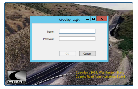
Mobility has been CRAB’s in-house road log inventory system for nearly two decades and has served the 39 counties well. However, as technology advances rapidly, even the best systems need to be replaced to keep up with user demand, new platforms like mobile, and threats in cybersecurity.
In December 2022, Microsoft announced the end of security updates for the server environment used to host Mobility. Without those critical updates, our agency and county road data would be at an unacceptable level of risk without either investing in updates to the hosting environment or decommissioning.
Industry leader Palo Alto reported that 50% of ransomware attacks are perpetrated using Remote Desktop Protocol (RDP) compromises which is the technology used for Mobility in 36 out of our 39 counties. After soliciting feedback on the issue via GIS-Mo Forum, individual county meetings, and a statewide county survey, we have determined that decommissioning Mobility will be the best use of our resources.
Decommissioning Mobility
Our staff has accelerated several projects to ensure data from Mobility remains accessible to every county but Mobility access will be discontinued on, or before, September 29th, 2023. To stay apprised of the ongoing projects and timeline for decommissioning, please attend our GIS-Mo Forum held first Tuesday of each month. You can also subscribe to GIS-Mo Forum mailing list.
What's Next? Looking Ahead to the Post-Mobility Era
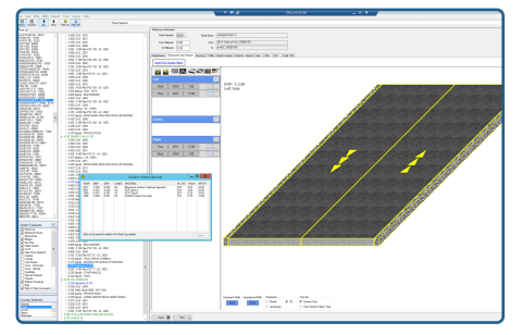
Mobility is being replaced by our current GIS-Mo technology to ensure accountability in county road departments and assists county personnel in their compliance with reporting requirements to CRAB, the State Legislature, and federal entities.
Utilizing the easy-to-use GIS-Mo program will provide a variety of advantages, including:
- GIS-Mo's cutting edge technology will allow users to access assets such as intersections, guardrails, signage and stormwater features in a geo-spatial environment, which will enable them to see gaps and overlaps of road systems and identify incorrect data.
- Counties will have real time data, enhancing their ability to make quality decisions through consistent, equitable, and defensible management plans and operations.
- Users will be able to easily upload quality control data and certification can be done without using hard copies.
- Helping Washington meet federal requirements for Model Inventory Roadway Elements (MIRE) Fundamental Data Elements.